Lamufutures
Process
How could a meaningful collaboration be developed between a local youth organisation and a university program based in Switzerland?
How could research-led pedagogy contribute to local empowerment and transformation?

Ocean as Method
Mobilising the ocean as both metaphor and material reality, this analytical lens centres the dynamism and fluidity of social processes.
Mobilising the ocean as both metaphor and material reality, this analytical lens centres the dynamism and fluidity of social processes.

Reciprocity
Striving for ways of working and outcomes that benefit all parties involved, emphasizing mutual exchange and understanding.
Striving for ways of working and outcomes that benefit all parties involved, emphasizing mutual exchange and understanding.

Positionality
Understanding how our individual and structural positions and movements shape research processes and final outcomes.
Understanding how our individual and structural positions and movements shape research processes and final outcomes.

Pedagogy
Lorem ipsum dolor sit amet, consectetur adipiscing elit, sed do eiusmod tempor incididunt ut labore et dolore laborum.
Lorem ipsum dolor sit amet, consectetur adipiscing elit, sed do eiusmod tempor incididunt ut labore et dolore laborum.
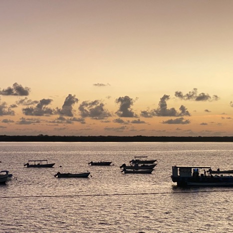
Ocean as Method
In Lamu as elsewhere, the ocean is not a natural boundary, or even an extension of the land. It is a crucial part of people’s livelihoods and belonging. Littoral societies are dependent on maritime ecologies and in constant exchange across the sea.
The cultural theorist Iain Chambers approaches the sea as a metaphor epitomizing the inherent instability and fluidity of knowledge production.
Examining the Lamu archipelago through a maritime lens means seeing the Indian Ocean not merely as a transit route for goods but also as the medium of everyday life and the connection between histories and futures.
Consequently, our work centers on the journeys, navigations, and livelihoods on the ocean, providing insights into the dynamics of the Lamu Archipelago and the Indian Ocean's paramount significance.
Using the ocean as a method presents its own challenges. As many residents in Lamu do not rely on conventional maps for navigation, mapping efforts relied on direct observations during boat trips.
“Some boat captains mentioned using stars for night-time navigation at sea. When inquiring about fishing locations, fishermen would gesture towards the water rather than pinpointing spots on a map.”
As a result, our research primarily relied on observations during boat trips, enabling us to map waterways and identify fishing and mangrove-cutting locations. Locals provided us with names of familiar places, common fishing spots, and descriptions of their routes, which we integrated with our tracking data to create accurate waterway maps.